Lake Map Main!
1861 Census
Parishes
Proprietors
Lot Maps
More to come!

Recommend Me! Suggest This Page To A Friend!


The 1863 Lake Map Of Prince Edward Island

P.E.I. Lot Map
Lot 5 Princetown Lot 6 Lot 11 Lot 13 Lot 14 Lot 16 Lot 17 Lot 18 Lot 19 Lot 20 Lot 21 Lot 22 Lot 23 Lot 24 Lot 25 Lot 26 Lot 27 Lot 28 Lot 30 Lot 31 Lot 32 Lot 33 Lot 34 Lot 36 Lot 37 Lot 38 Lot 39 Lot 40 Lot 41 Lot 42 Lot 43 Lot 47 Lot 49 Lot 50 Lot 54 Lot 55 Lot 56 Lot 59 Lot 61 Lot 63 Lot 64 Lot 65 Charlottetown Princetown Charlottetown Lot 1 Lot 2 Lot 3 Lot 4 Lot 7 Lot 8 Lot 9 Lot 10 Lot 12 Lot 15 Lot 67 Lot 29 Lot 57 Lot 58 Lot 60 Lot 62 Lot 66 Lot 51 Lot 52 Lot 53 Lot 44 Lot 45 Lot 46 Lot 35 Lot 48 Gtown Gtown
Charlottetown City Proper Map - Large, 370K
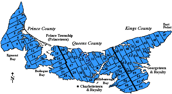
Click on Lot number to view the map image for that lot!

Note: It took us a while to find a map with the Charlottetown proper portion reasonably intact. This portion is located in the upper right corner of the map, and is an area where the media is most subject to damage by repeated rolling, with the result that most remaining Lake Maps are severely damaged in this area and on the opposite side, where some of the West Prince lots are located. Thanks to Dillon Sheehan for allowing us to photograph his map, and to Garth for photographing it. This is a big deal, as these maps are damaged more and more each time they are unrolled, and we appreciate his allowing us to access his map. We will continue trying to find better scans of all maps.

1863 Lot 28 Index. by Ari Dale

Lake Map Main!
1861 Census
Parishes
Proprietors
Lot Maps
More to come!

Dave Hunter and The Island Register: HTML and Graphics©

Last Updated: 11/19/2006 4:55:00 AM
Return to Top!
[ Return to Feature Index Page!] | [Return to Main Page! ] | [Return to Census Index! ]